|
Black's Maps |
| Most of the railroads have a "Black's
Map Number." These identify the railroad on the appropriate map from
Black's Railroads of the Confederacy. To view Black's maps, you will
need Adobe Acrobat Reader on your computer (get a free copy here). (If
you have Reader on your machine and the map will not open in your browser,
right-click on the link below and Save Target As. After it is saved to your
machine, it should open.) |
| (From THE RAILROADS OF THE CONFEDERACY by
Robert C. Black, III. Copyright (c) 1952 by the University of North Carolina
Press; renewed 1980 by Robert C. Black, III. Used by permission of the
publisher. All rights reserved. www.uncpress.org) |
| |
| Eastern
Railroads map |
| Western
Railroads Map |
| |
| Numerical Key to Railroad Numbers |
| |
|
Atlas to Accompany the Official Records |
| City and Area Maps of Confederate Railroads |
| |
|
Web Maps |
| There are other maps that you can see on line. Each of these
maps has omissions and may have non-operating railroads mapped as though they
were operating. |
| |
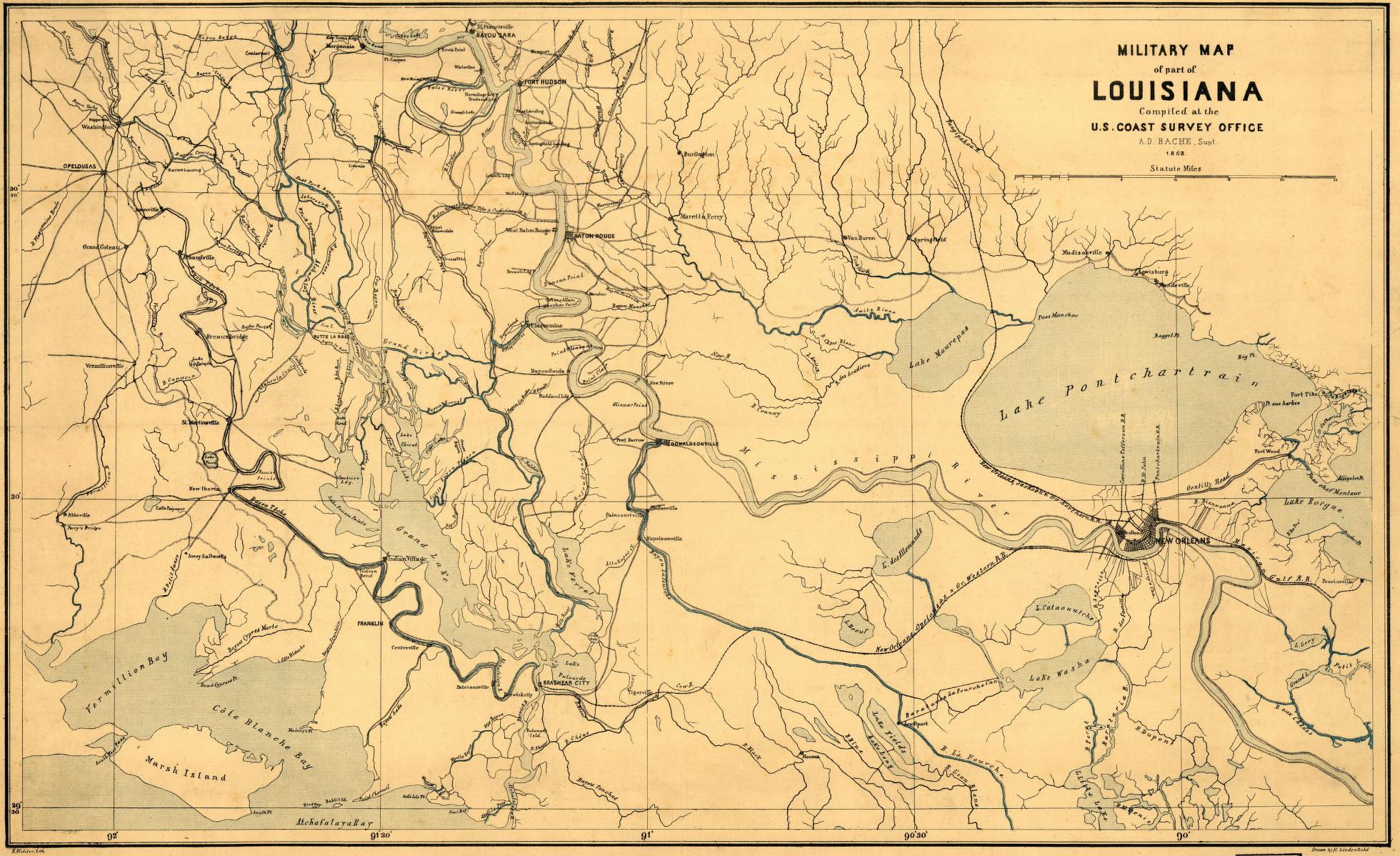
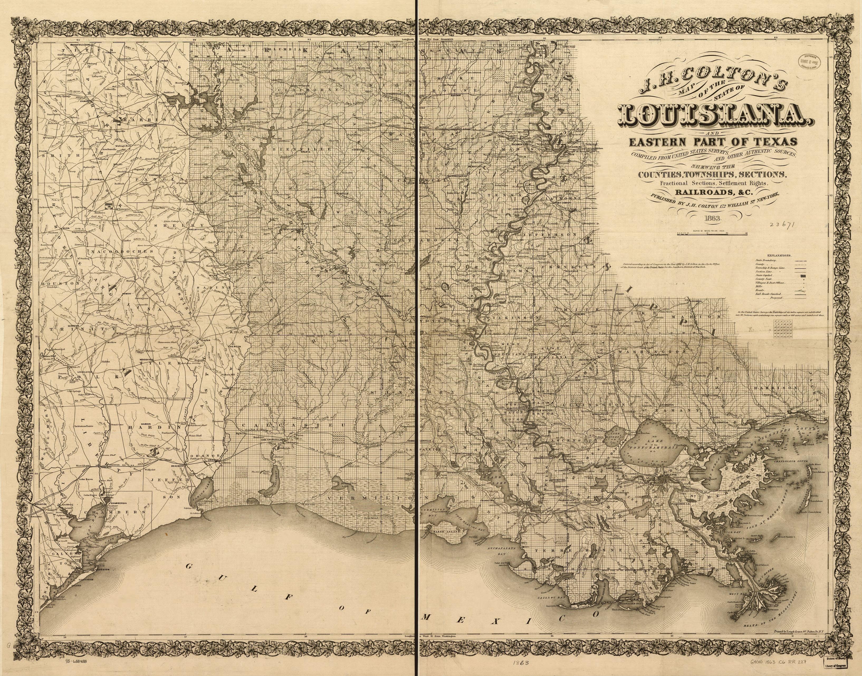
| Louisiana
Railroads 1863 |
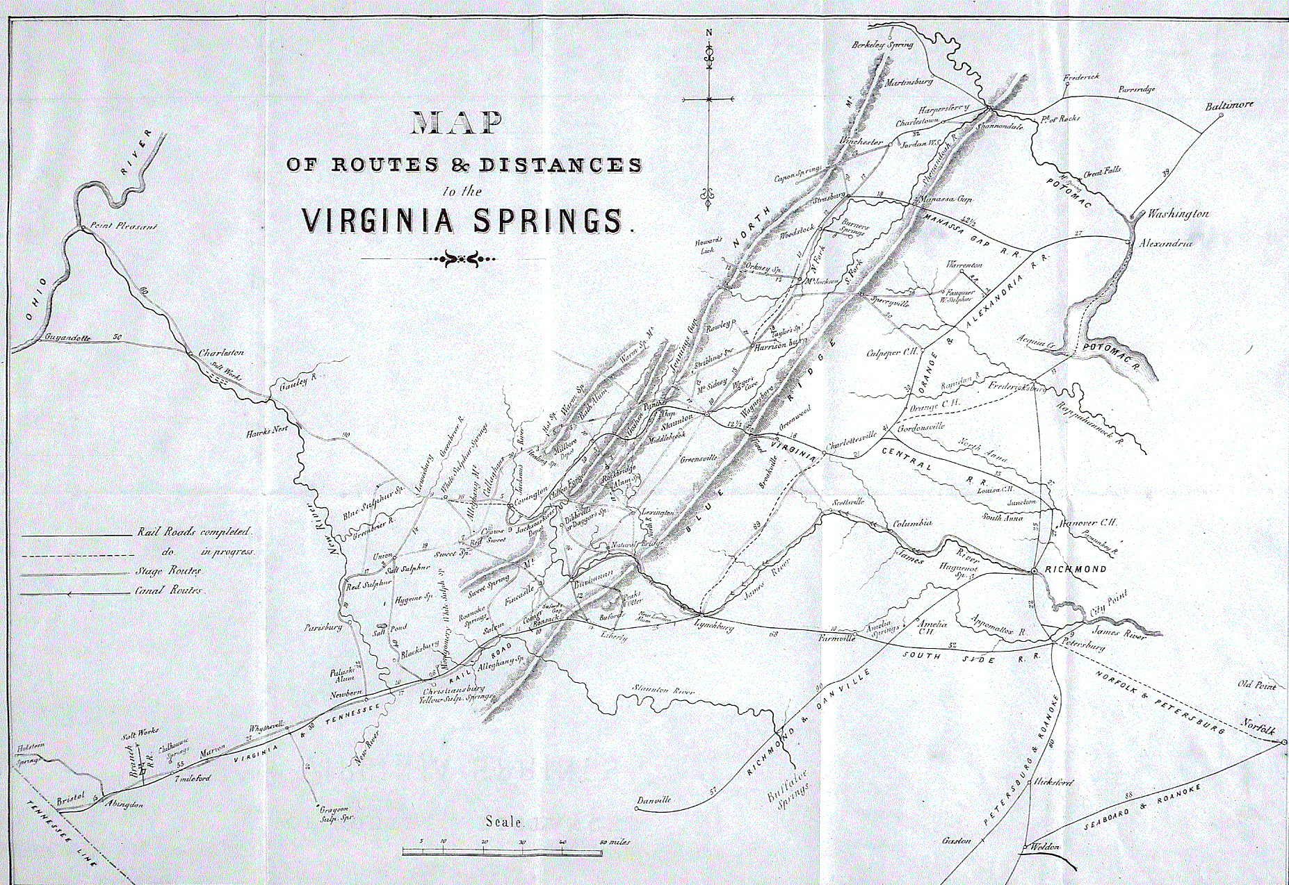
| Virginia Railroads 1859
(Colonial Williamsburg Foundation, Colonial Williamsburg, Virginia) |
| West Point Confederate Railroad
Map (www.Military.com)
I've added many smaller roads that are not on the West Point version. |
| |
|
Library of Congress Maps |
| Alabama
& Tennessee Rivers Railroad, 1867 (Library of Congress, Prints &
Photographic Division, #316) |
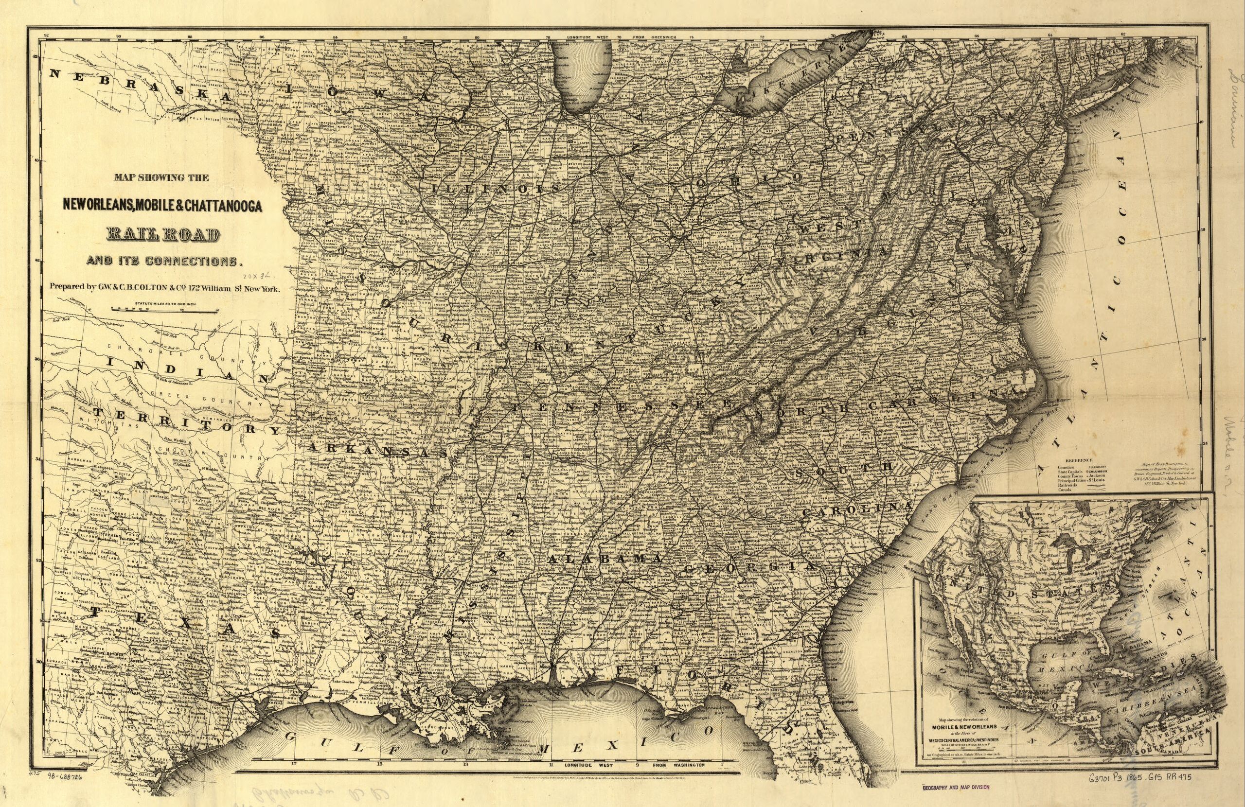
| Eastern US Railroads, 1865
(Library of Congress, Prints & Photographic Division, #476) |
| Florida Railroad, 1860
(Library of Congress, Prints & Photographic Division, #407) |
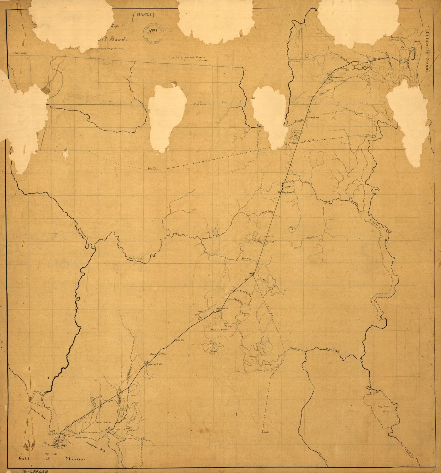
| Louisiana and Eastern Texas, 1863
(Library of Congress, Prints & Photographic Division, #227) |
| Memphis Railroads
Connections Tom Parker (www.memphisrails.com)
has taken a Library of Congress map made at the order of General Sherman
and indicates on it the connections the Confederacy made to connect the
three Memphis railroads. The Memphis & Ohio RR come in from the upper
right and goes to the river front. The Memphis & Charleston RR comes
in from the middle right and ends in the middle of the map. The
Mississippi & Tennessee RR comes in from the bottom and ends where the
road appears to turn due north. The red dashed lines are the Confederate
additions to connect the three roads. |
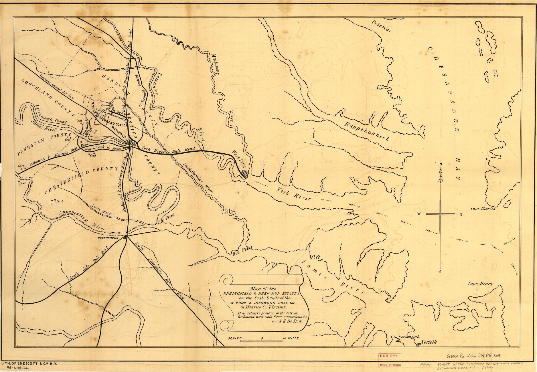
| Richmond Area Railroads
1856 (Library of Congress, Prints & Photographic Division, #309). Shows
the proposed (and never built) link from the Hungary Branch coal pits to the
Richmond & York River Railroad's terminal at West Point. Also shows the
Tuckahoe & James River Railroad. It incorrectly shows the Chesterfield
Railroad (on the south side of the James River) -- a road that had ceased
operation in 1852 and had its rail removed. |
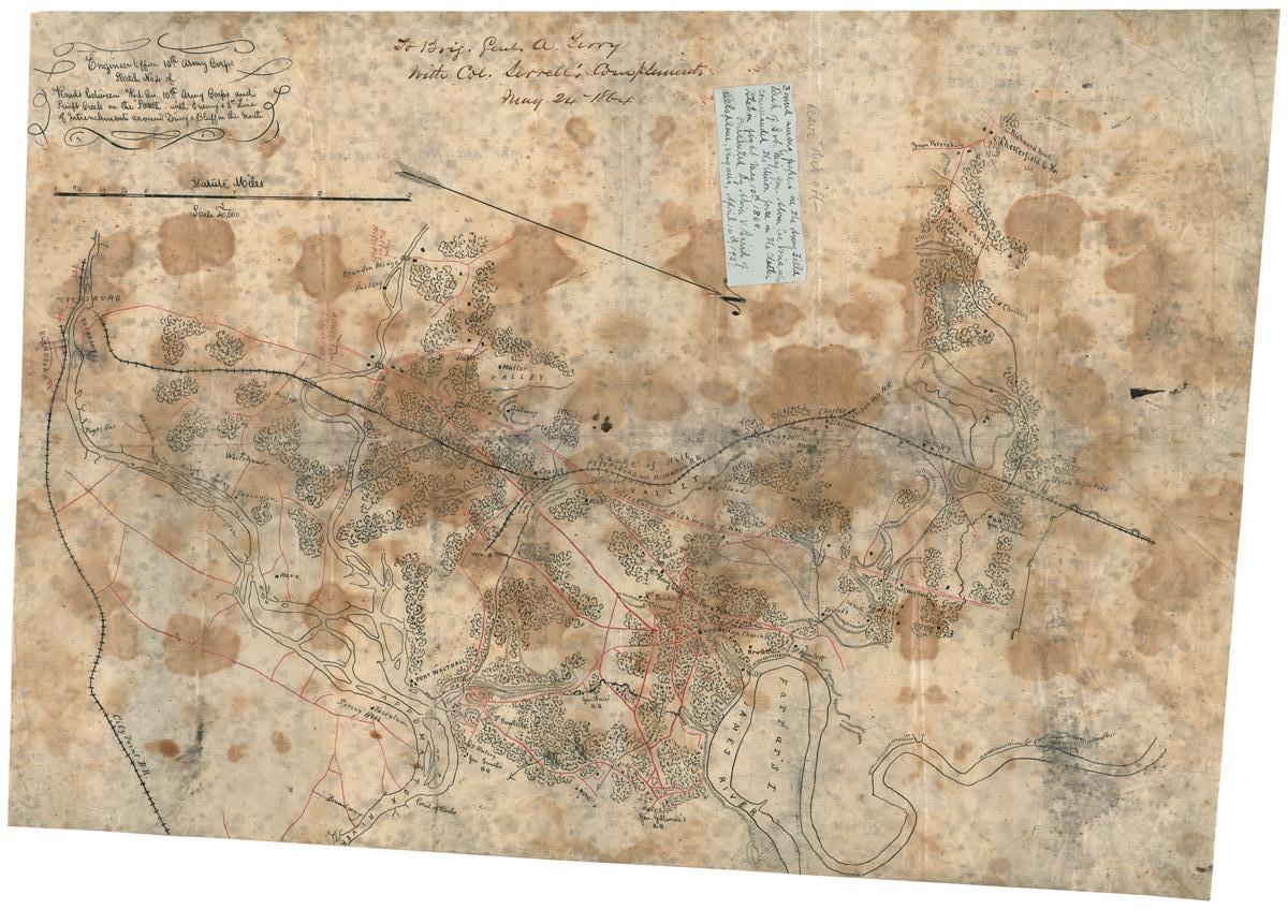
| Richmond &
Petersburg Railroad (Library of Congress, from the Library of
Virginia.) Shows the road from just south of Richmond to Petersburg. The
annotation on the map itself says: "To Brig. Gen. A. Terry, with Col.
Serrell's complements, May 24th, 1864." The white paper attached to
the map says: "Found among papers in the army field desk of Bvt. Maj.
Gen. Alvin Coe Voris, who commanded the Union force in the Chester Station
fight, May 10th, 1864. Presented by Alvia V. Baird of Delaplane, Virginia, April 10th 1937." |
| Richmond,
Fredericksburg & Potomac Railroad, 1863 This is a Union map of the
section from Fredericksburg to Acquia Wharf. The iron was Union, but the
route and road bed were pre-war. The Confederacy removed the iron from
this section at least once. |
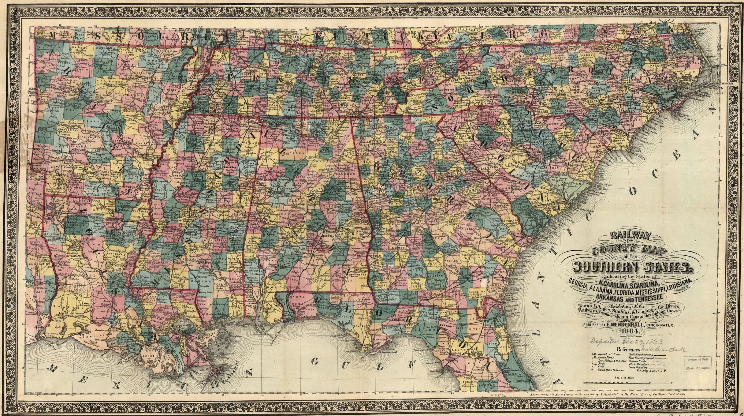
| Southern Railroads, 1864
(Library of Congress, Prints & Photographic Division, #141) |
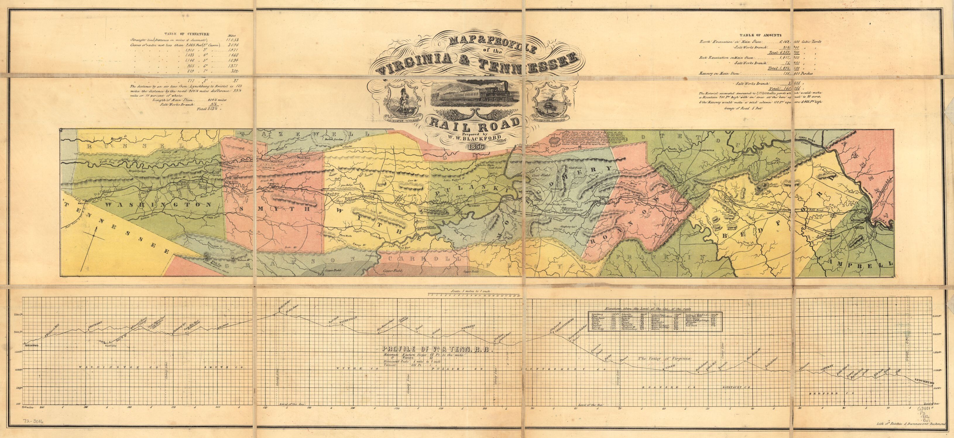
| Virginia & Tennessee Railroad
1856
(Library of Congress, Prints & Photographic Division, #400) |
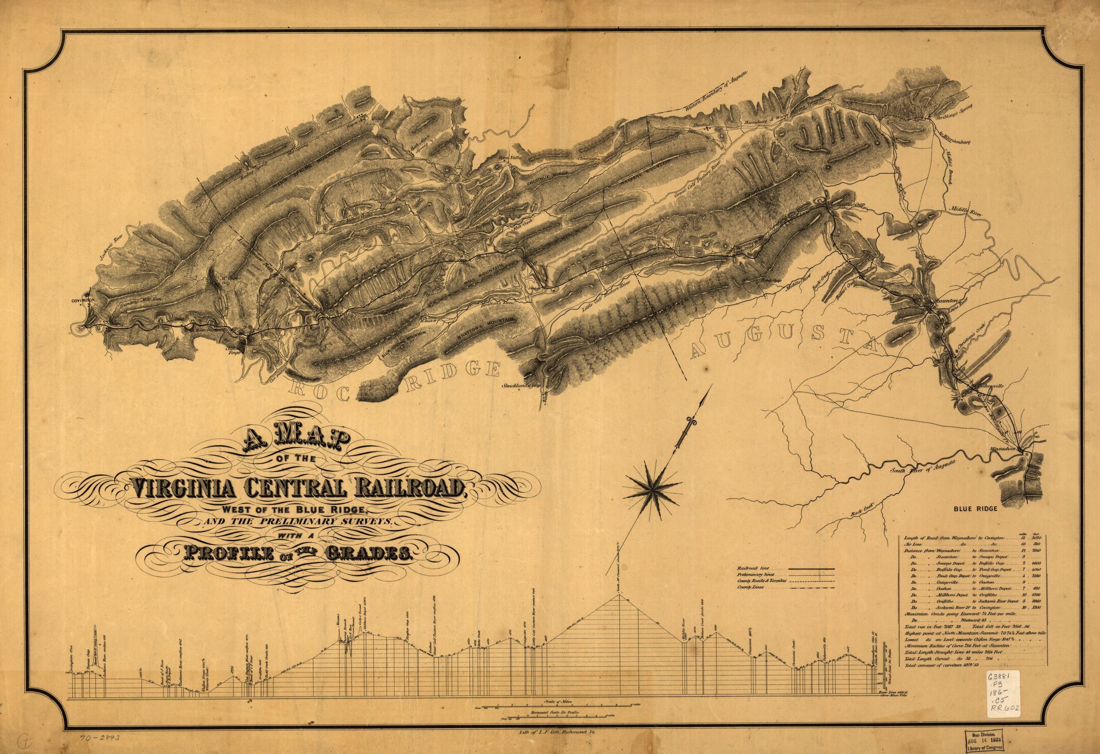
| Virginia Central
Railroad (Western part, from Waynesboro to Covington) about 1860 (Library of
Congress, Prints & Photographic Division, #602) |
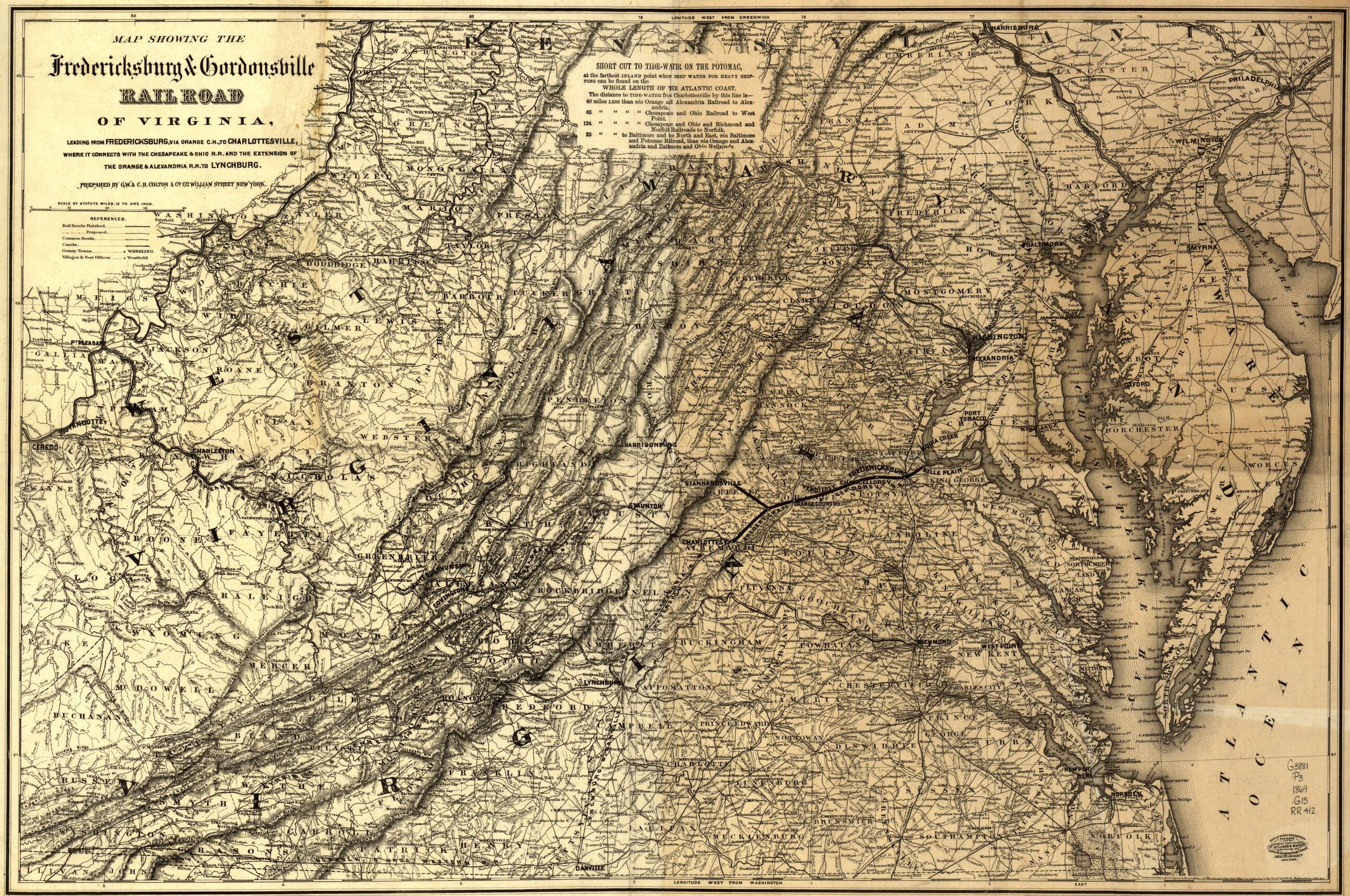
| Virginia Railroads, 1869
(Library of Congress, Prints & Photographic Division, #412) |
| |
|
National Archives |
| Some of these maps are available at Fold3.com |
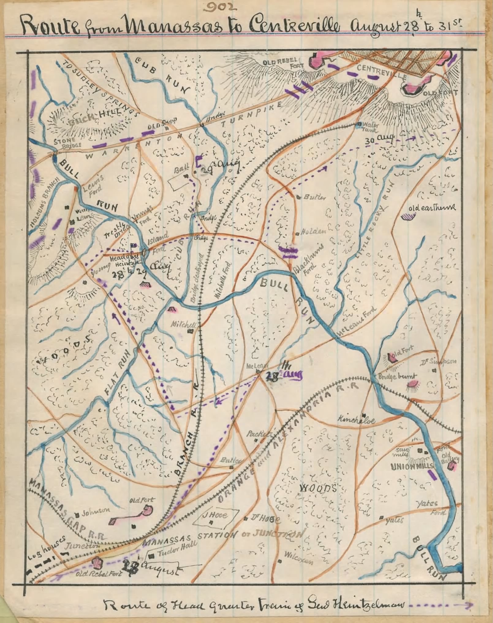
| Centreville RR |
| Sharp Locomotive
Haul The area where Capt. Sharp hauled away Baltimore & Ohio
RR locomotives and cars |
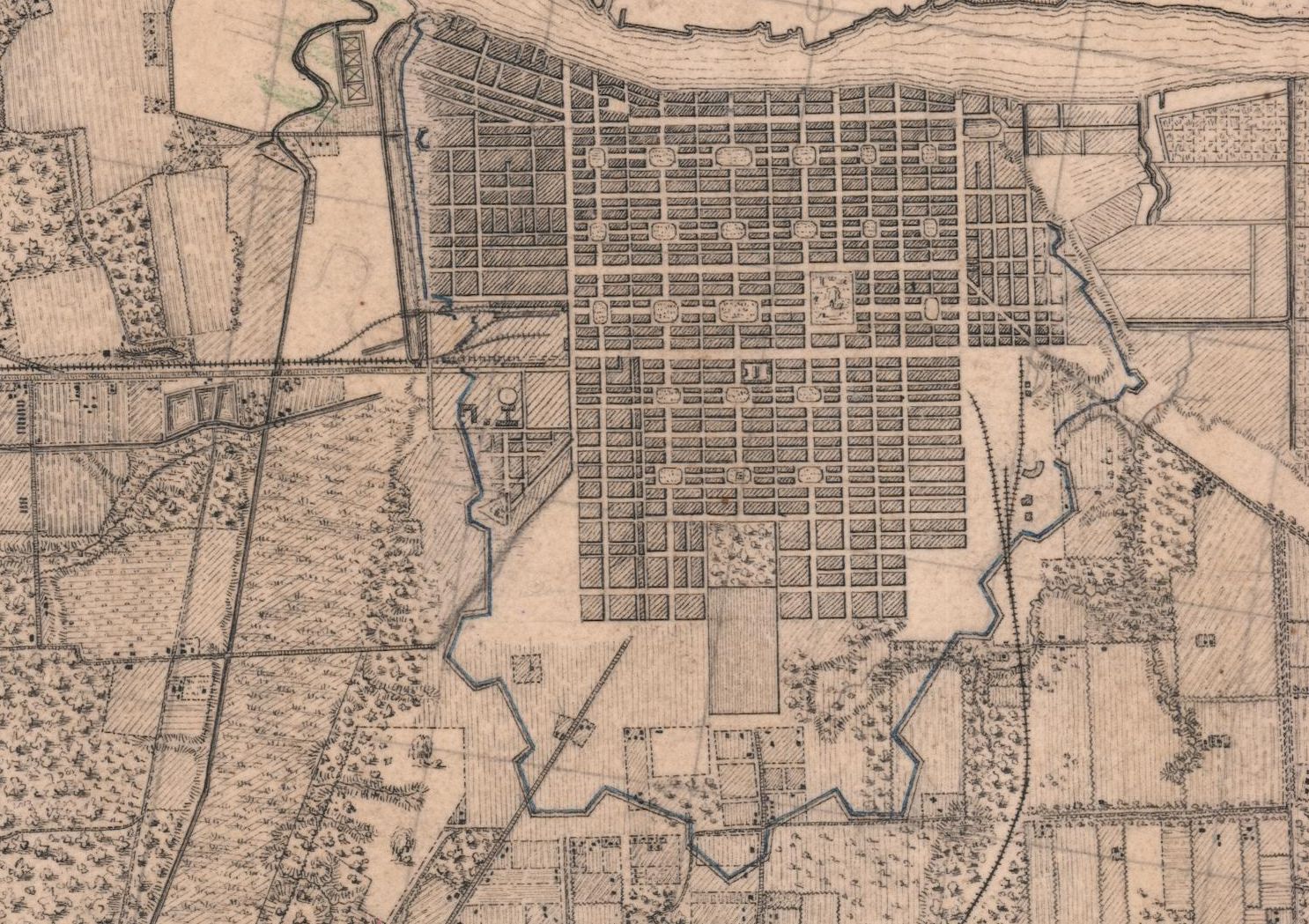
| Savannah The railroad
from the left is the Central (of Georgia) and the one from the bottom is the
Savannah, Albany & Gulf. Note the railroad buildings for both roads. |
|
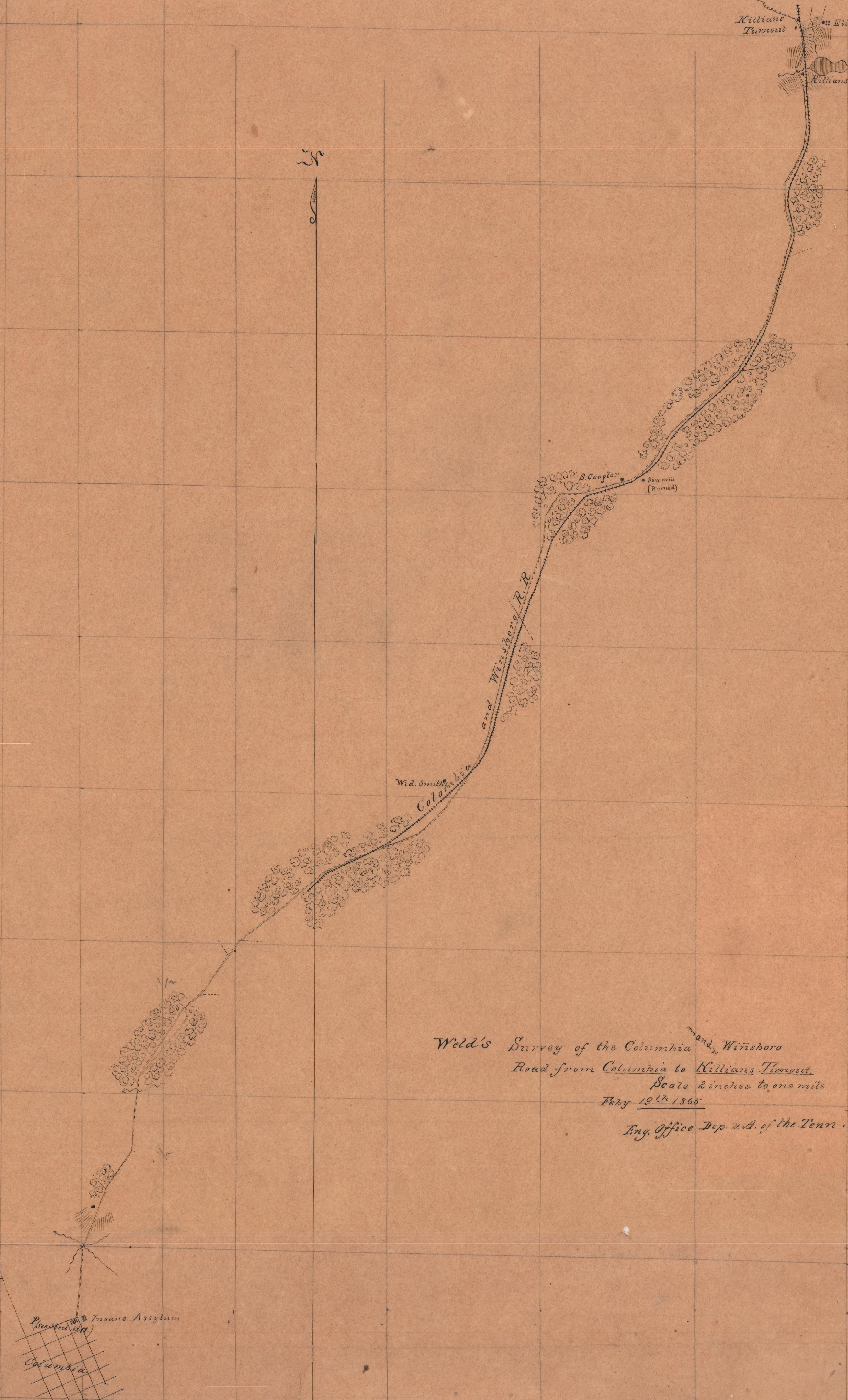
Charlotte & South Carolina RR This shows the ten miles from Columbia to
Killian's Mill, all of which was destroyed by Sherman. |
| Norfolk
& Petersburg RR |
| Eastern
Texas Railroads These roads were considered essential to the defense of
Houston. |
| Southeastern
Texas |
| Orange, Texas The
railroad is the Texas & New Orleans RR |
| Orange County Tx. |
| Tennessee
& Alabama RR 22 miles from Columbia to Franklin |
| Brashear, La. The
New Orleans, Opelousas & Great Western RR was graded 45 miles out of
Berwick, but no iron is known to have been laid. North is to the right on
this map. |
| Galveston, Tx.
The Galveston, Houston & Henderson RR enters the city from the upper left
and continues out to the various batteries. The date is probably early 1864. |
|
Western Tennessee & Kentucky |
| |
|
Other Maps |
| Alabama &
Mississippi Rivers RR at Demopolis A copy of the 1863 Confederate map
found in the Demopolis, Ala. Library and provided by Richard McCardle. |
| Central (of
Georgia) RR, Eatonton Branch This map of the movements of Sherman's
troops through Putnam County, Ga. in November 1864 was created in 1961 by
Katherine Walters from an earlier, lost, map. The track runs from Eatonton
south through Dennis and south to the bottom of the map. |
| Lynchburg Railroads, Detail
An 1860 map of the railroad lines and buildings in Lynchburg. |
| Mobile
RRs and Defenses From the top is the Mobile & Ohio RR; from the left is
the Mobile & Spring Hill RR. (from UNC Chapel Hill, Gilmer Papers) |
|
Petersburg
RRs, East Side of City From the right side is the City Point Branch of
the South Side RR; from the lower left is the Petersburg RR. (from UNC
Chapel Hill, Gilmer Papers) |
| Weldon
RRs and Defenses From the lower left is the Raleigh & Gaston RR; from
the lower right is the Wilmington & Weldon RR; going up, over the Roanoke
River, is the Seaboard & Roanoke RR. (from UNC Chapel Hill, Gilmer Papers) |